CIA MAPS
November 12, 2008
OVERALL: The CIA has a map library with every kind of map. If they don’t have what someone in the agency needs they will make it.
OPERATIONS CENTER WALL MAP: There is a wall map in the Operations Center that lights up and is interactive.
1. CIA WORLD FACTBOOK: Maps for the public to access.
https://www.cia.gov/library/publications/the-world-factbook/docs/refmaps.html
2. Perry-CastaÒeda Library
Map Collection
The largest public domain map collection. Located at the University of Texas.
3. Historic CIA map of West Berlin Transportation:
http://www.lib.utexas.edu/maps/world_cities/wberlin_transport_78.jpg
4. CIA Maps of Poland (1982-2008):
http://www.lib.utexas.edu/maps/poland.html
Includes maps with icons representing economic activity, an industry map with various pie charts for each region (mining, iron, steel, chemicals, food), color-coded for land use and for population.
5. CIA Bosnia Herzegovina (1992-2002)
http://www.lib.utexas.edu/maps/bosnia.html
Included maps of economic and natural resources, Bosnian military offensive operations, ethnic majority areas, Muslim resettlement areas, and troop deployment.
6. Thematic maps (includes sources other than CIA):
http://www.lib.utexas.edu/maps/thematic.html#military.html
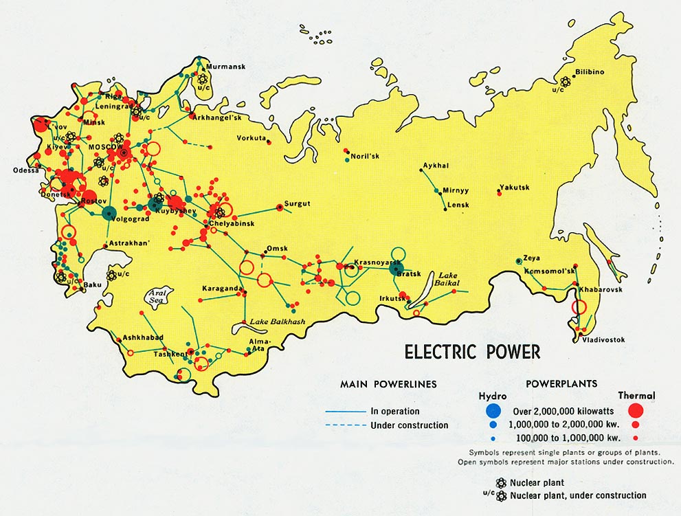
Soviet Eelctric Power: http://www.lib.utexas.edu/maps/commonwealth/ussr_elec_1974.jpg
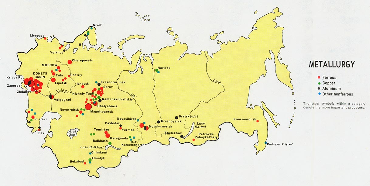
Soviet Metallurgy:
http://www.lib.utexas.edu/maps/commonwealth/ussr_metal_1974.jpg